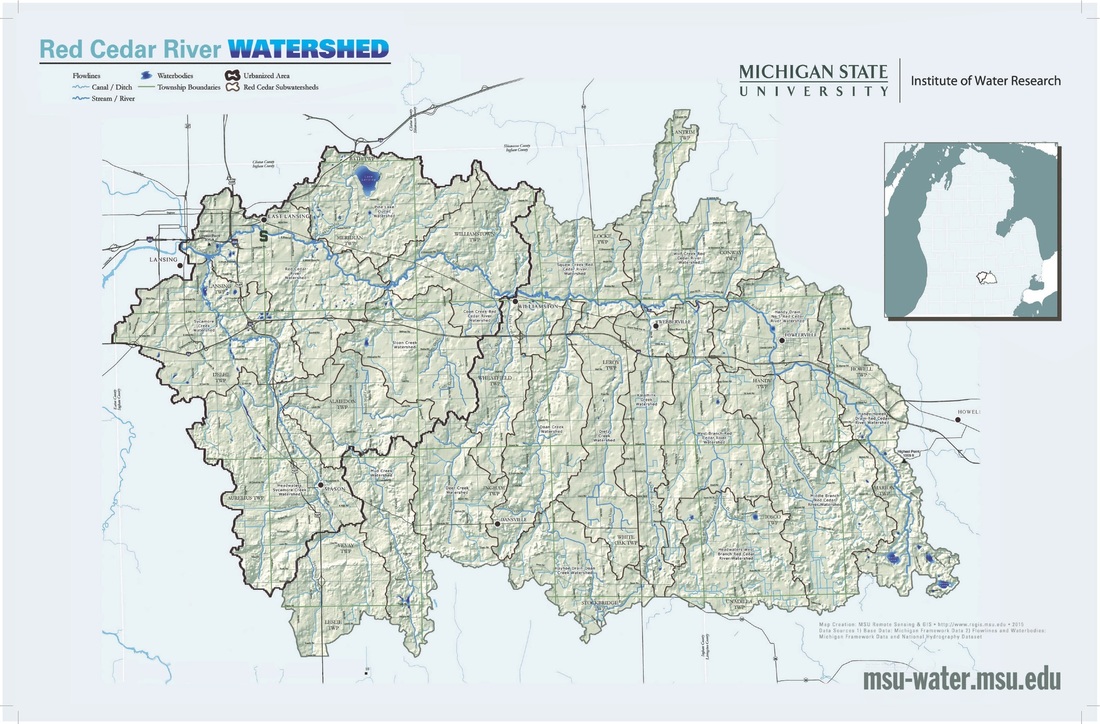
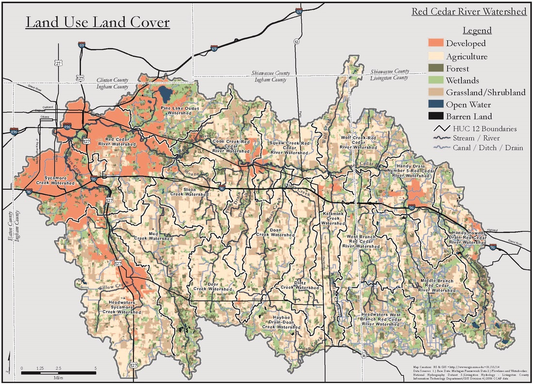
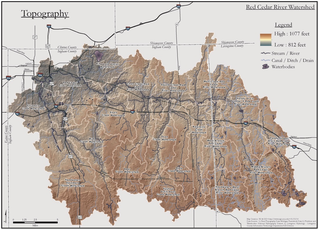
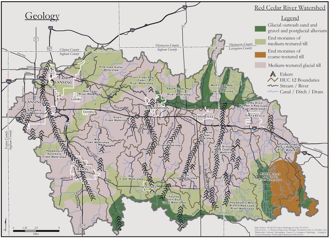
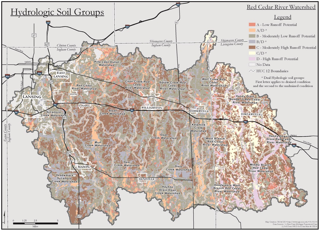
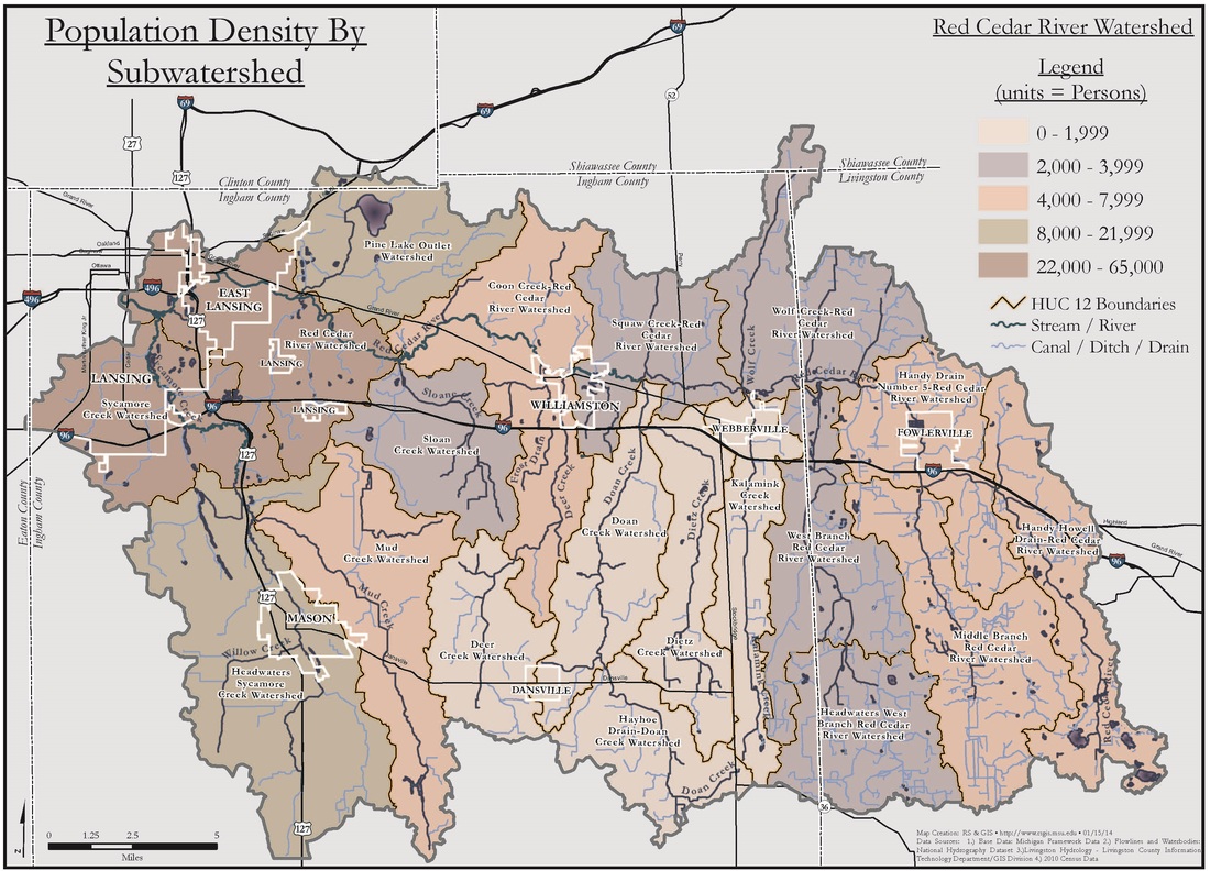
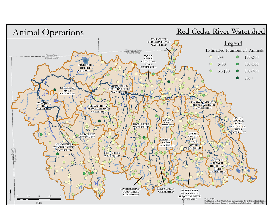
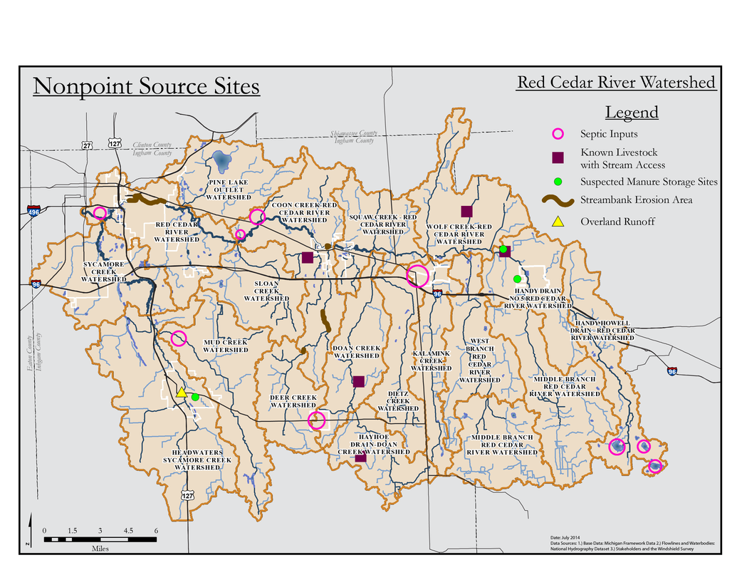
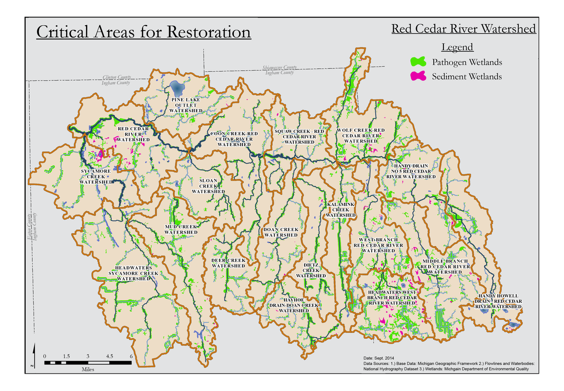
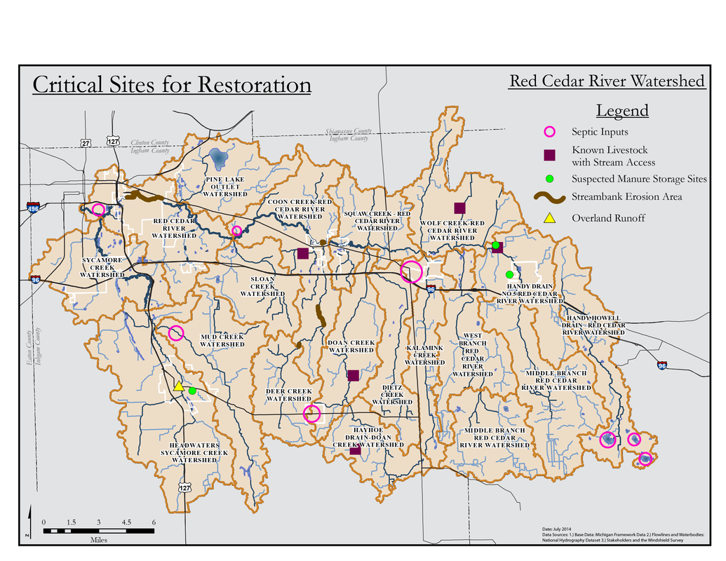
Michigan State University | Red Cedar River Watershed
  • Home
  • Red Cedar Watershed
    • What is a Watershed?
    • Watershed Facts
    • Watershed Health
    • Map Gallery
  • Watershed Management Plan
  • Information for Homeowners
  • Information for the Agricultural Sector
What is a Watershed?

Watershed Facts

Watershed Health

Homeowners

Agriculture

Management Planning

Map Gallery

Additional Resources

Map Gallery

Below are several maps showcasing various aspects of the Red Cedar River Watershed such as land use, topography, population density and more.  

Hover over a thumbnail for a brief description of the map. Maps can be viewed in a slider by clicking on one of the maps and using the left and right arrows to change between maps. To view the map in detail or to download it, open the map in new tab.  Right-click a thumbnail and select "Open Link in a New Tab."
Red Cedar River Watershed Map
Land Use Land Cover
Topography
Geology
Hydrologic Soil Groups
Population Density by Subwatershed
Animal Operations
Nonpoint Source Sites
E. coli TMDL
Dissolved Oxygen TMDL
Red Cedar River Watershed Monitoring Sites
Potential Areas for Conservation
Critical Areas for Restoration
Critical Sites for Restoration
Powered by Create your own unique website with customizable templates.