What is a Watershed?
A watershed is an area of land that drains to a common waterway. Rainfall, irrigation water, and groundwater within the Red Cedar River Watershed all flow to the Red Cedar River. Everyone lives in a watershed and residents’ behaviors and land use practices in the watershed affect the health of the common waterway.
The boundaries of a watershed differ from traditional political boundaries and are based on the flow direction of the surface and groundwater. After water in this watershed reaches the Red Cedar River, it continues on to the Grand River and eventually to Lake Michigan. Our behaviors in this area have the potential to not only affect the Red Cedar River flowing through our community, but to affect the water flowing into Lake Michigan! 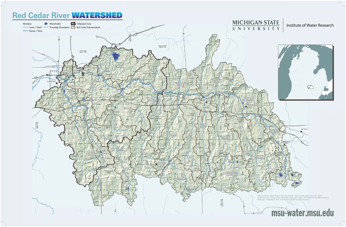
Subwatershed boundaries in the Red Cedar River Watershed. Click on the image to enlarge it. To download a copy of this map, go to the "Map Gallery."
|
Want to learn more? Visit mywatersheds.org
|
